
May 27, 2014
EarthScope, a Grand Earth-Observing Project with an Epic Future
Posted by kcompton
By Linda R. Rowan, Director of External Affairs, UNAVCO
and J Ramon Arrowsmith, EarthScope National Office Director and Professor of Geology, Arizona State University
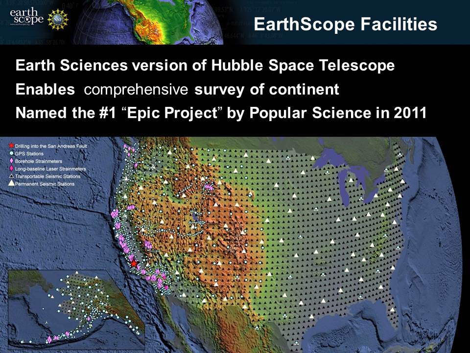
EarthScope infrastructure across the United States. Credit: Jeffrey Freymueller
EarthScope is a grand earth-observing project funded by the National Science Foundation that has had many science discoveries, technological innovations and broader societal benefits. For example, Popular Science declared it the “most epic” science project in 2011. EarthScope has several large-scale and mostly distributed observatories. The project celebrated a decade of success and a consideration of its future with a symposium, reception and congressional briefings in Washington DC in May, 2014.
The USArray is a network of seismic instruments placed throughout the United States and Canada. This network includes an array of 400 seismometers moving across the country as well as additional seismometry arrays for focused regional studies and a magnetotelluric array for measuring electric and magnetic fields emanating from Earth’s interior.
A permanent network of instruments, called the Plate Boundary Observatory (PBO) examines the Pacific plate interaction with the North American plate. The network includes 1,100 continuous GPS stations, 145 meteorological instruments, more than 75 borehole geophysical tools, 6 laser strainmeters and other tools like tiltmeters. Most of PBO is concentrated in the Western U.S., along the San Andreas Fault, the Cascadia Subduction Zone and along the subduction zone boundary that forms the Aleutian Arc where 130 active volcanoes line-up and demarcate the southern edge of Alaska.
The third component is a deeply drilled hole that penetrated about 2 miles below the surface along the San Andreas Fault. The San Andreas Fault Observatory at Depth (SAFOD) provided the first opportunity to directly observe the conditions along a fault under which earthquakes and aseismic slip occur.
EarthScope has collected data for a decade and made numerous discoveries about the solid Earth and the atmosphere in North America. We know more about how the major plates move, how earthquakes work, how active volcanoes are, how severe weather and hurricanes track, how space weather forms, how glaciers change and how water is stored near the surface in soil, vegetation and snow pack.
The National Science Foundation is supporting a continuation of EarthScope for 5 years, ending in 2018. Beyond science discoveries, data, and innovations, there are broader societal benefits. Some broader benefits include earthquake early warning, volcano hazard monitoring, weather forecasts, water resource management, land-use management, surveying, and engineering. EarthScope has a broad network of informal educators at national, state, and local parks and monuments, and its data and understanding are essential for earth science education.
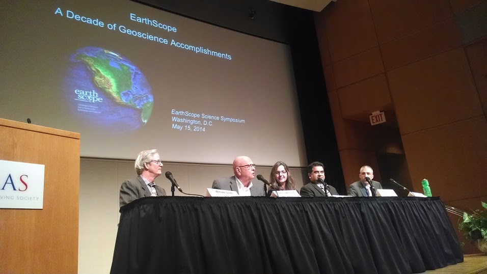
Federal government panel discussion about EarthScope at the May 15, 2014 EarthScope Symposium in Washington DC. The panelists include from left to right, William Leith, U.S. Geological Survey, Senior Advisor on Earthquake and Geological Hazards
John LaBrecque, National Aeronautics and Space Administration, Lead, Earth Surface and Interior Focus Area, NASA Science Mission Directorate
Juliana Blackwell, National Oceanic and Atmospheric Administration, Director, National Geodetic Survey
Iftikhar Jamil, National Oceanic and Atmospheric Administration, National Weather Service, Chief Information Officer
Gregory J. Anderson, National Science Foundation, Geosciences Directorate, Division of Earth Sciences, Program Officer for EarthScope
Photo Credit: J Ramon Arrowsmith
What happens after 2018 will depend on what the Earth science research community decides, what the National Science Foundation’s priorities are, and whether agency partners or other stakeholders want to continue to use all or part of the project. Some of the Federal agencies that use EarthScope the most, include the U.S. Geological Survey, the National Oceanic and Atmospheric Administration, NASA, the Federal Emergency Management Agency, the Department of Energy, and the Nuclear Regulatory Commission.
A significant component of EarthScope that should be maintained for the long term are the data and data services. UNAVCO maintains the geodetic data, the Incorporated Research Institutions for Seismology maintains the seismic data and Texas A&M University maintains the SAFOD data, especially the physical core materials from the drilling. All of the institutions have an open access to data policy and consideration for data services beyond 2018 is important to maintain these valuable resources.
We have grown to rely on the great practical value of the observational infrastructure of EarthScope. Support has been authorized to maintain 25% of the USArray of seismometers in the Eastern U.S. as a permanent network. This decision was driven by the dearth of seismic monitoring in the East and accelerated by the 2011 Mw 5.8 Mineral, Virginia earthquake that shutdown the North Anna nuclear generating station. It reminded policymakers, especially those in Washington DC who experienced the earthquake, that damaging events can occur in the East (e.g. New Madrid events in 1811-1812 and the Charleston earthquake of 1886).
The Plate Boundary Observatory is a large, permanent geodetic network. Beyond hundreds of successful research projects, the GPS stations and other tools are used by Federal, state and local agencies for hazards, resource management and land-use planning and by commercial users for surveying and engineering. At least 50% of the real-time GPS data users are from the commercial sector. Maintaining or upgrading this infrastructure beyond 2018 has research and broader benefits. Discussions need to begin regarding who will support PBO beyond 2018, how many partners might be involved, and how much of the infrastructure might be maintained or upgraded.
EarthScope is epic and the odyssey for science, innovation and broader impacts continues for more than a decade, until at least 2018. The potential for research is great and the utility of operationalizing components for applied research and broader impacts is significant. The EarthScope organizers and stakeholders need to find the best path to reach these ambitious goals.
Linda R. Rowan is Director of External Affairs at UNAVCO. UNAVCO is a non-profit university-governed consortium that facilitates geoscience research and education using geodesy. Linda focuses on open access to data, international cooperation through geodesy, and policy and media relations for UNAVCO. She has a BS in Computer Science/Math and Geology from the University of Illinois at Urbana-Champaign and a Ph.D. in Geology from the California Institute of Technology.
J Ramon Arrowsmith is the Director of the EarthScope National Office and the Chairman of the EarthScope Steering Committee. He is also Professor of Geology in the School of Earth and Space Exploration at Arizona State University. He has interests in earthquake geology, tectonic geomorphology, and large scale science organizations among numerous other topics. He is originally from New Mexico, and has a BA from Whittier College and a Ph.D. from Stanford University.


